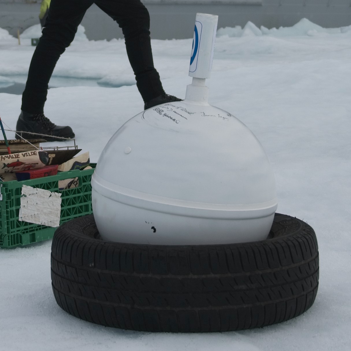
When travelling to the Arctic for science, scientists take so-called ice buoys with us. They usually look like a very big basketball, and they can fit in a car tire - that makes transporting them easier. They contain a bunch of scientific instruments that can be used to study different things. Upon arrival in the Arctic, an ice buoy is placed on top of the sea ice in a spot that will not melt for as long as possible. And then it records a bunch of information that can be used! Ice buoys are battery-powered, and their batteries usually last about one and a half years. That is a long time to get lots of information for.
The ice buoys belong to and contribute to a big international research project, called the International Arctic Buoy Programme (IABP). The information received from the buoys help support that program, together with over 100 other buoys spread out over the Arctic. By having so many buoys in different places, a large area of the Arctic is covered, and the data from each buoy can be seen in context of all the other buoys. This can help identify patterns spanning thousands of kilometers, that one buoy alone would not be able to see.
What kind of information do ice buoys collect?
Ice buoys can be equipped with different instruments, but the most common ones are the following:
GPS to record position and movement
GPS stands for "global positioning system", and many things have them built in today. Your smartphone for example, or navigation systems in cars. By having a GPS attached to something, you can always know where exactly it is. Sometimes that would be handy for finding your keys, or math book at home, don't you think? And the Arctic is way bigger than your home. Knowing where exactly the ice buoys are is super important for our project, because by recording the buoy's position several times a day, every day always at the same time, it can be tracked over time - see scientific data. One can then also calculate how fast the ice buoy on top of the sea ice has been drifting!
We get the buoy's changes in position, and we can calculate the distance the sea ice drifts, as well as the speed it drifts at. This tells us a lot about the sea-ice drift. We learn where a particular piece of sea ice drifts over time, and how fast it drifts, too. We can see if the sea ice with our buoys on it follows the common paths: the Beaufort Gyre or the Transpolar Drift.
Thermometers to measure surface air temperature
The air temperature in the Arctic can be really really cold during the polar night, down to minus 40°C. In summer, temperatures of around plus 10°C are possible. Changes in air temperature in the Arctic are interesting to look at over long timeframes.
Barometers to measure air pressure
A specific amount of air has a specific weight, even though you might not have realized that. And air is not always super evenly distributed around earth in the atmosphere. Sometimes there is more above an area, and sometimes there is less, it moves constantly. Above the atmosphere, the thin layer that contains air, surrounding the Earth, there is no more air - space is a vacuum. With more air moving into the atmosphere above an area, more air rests over the surface there, weighing more than before. If this happens, the air pressure in that area increases, because more air is exerting pressure downwards towards the surface. The exact opposite happens when less air than before is present over an area - the air pressure decreases, because there is less air is pushing downwards with its weight.
Data loggers to transmit the data to satellites
All this information these scientific instruments can record is great - but scientists need to be able to get that information to use it. And since one can't hunt down the buoys to download the information from them when their battery is dead, a better way to get it is necessary. And interestingly, this way is very long! A data logger in the ice buoy records the data and then sends it to space. There, satellites receive the data, and the information can be accessed back down on Earth.